
Fair-a-Far Cottages, Cramond
Introduction
The photograph on this page of Fair-a-Far Cottages, Cramond by Ian Dodds as part of the Geograph project.
The Geograph project started in 2005 with the aim of publishing, organising and preserving representative images for every square kilometre of Great Britain, Ireland and the Isle of Man.

There are currently over 7.5m images from over 14,400 individuals and you can help contribute to the project by visiting https://www.geograph.org.uk
Fair-a-Far Cottages, Cramond
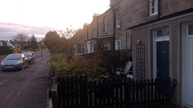
Image: © Ian Dodds Taken: 4 Nov 2023
As the long Whitehouse Road gets nearer Cramond the gaps between the houses get progressively smaller - as do the houses themselves - culminating in this old terrace. There are 24 addresses in all. Each house is divided in two with ground floor addresses at the front and first floor addresses at the back. The odd name comes from a former mill, the big ruins of which can be seen on the footpath that runs alongside the River Almond. A mill (always represented on old maps by what looks like a childish drawing of the sun but is probably meant to represent a waterwheel) of exactly the same spelling, minus the dashes, appears on a 1682 map. The best researched articles say that it was used for cloth-cleaning and food-making before becoming one of a group of four mills at Cramond involved in iron-working in the late 18th Century. An interesting point is that no domestic iron was used - it was all imported from Russia and Sweden, presumably as theirs was of better quality. Nobody has a theory on how the mill got its name. One map, from the 1810s, spells it as 'Faireyfar', conjuring up images of riverbank fairies in times gone by, when people believed in such things.
Images are licensed for reuse under creativecommons.org/licenses/by-sa/2.0
Image Location

Latitude
55.973685
Longitude
-3.303933