Flood defence at Upton-upon-Severn
Introduction
The photograph on this page of Flood defence at Upton-upon-Severn by Trevor Rickard as part of the Geograph project.
The Geograph project started in 2005 with the aim of publishing, organising and preserving representative images for every square kilometre of Great Britain, Ireland and the Isle of Man.

There are currently over 7.5m images from over 14,400 individuals and you can help contribute to the project by visiting https://www.geograph.org.uk
Flood defence at Upton-upon-Severn
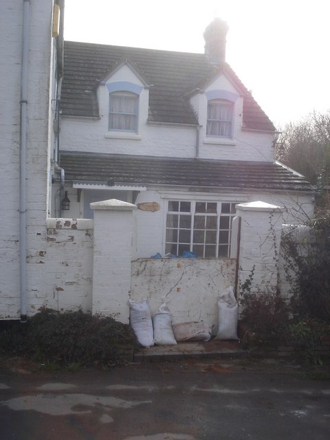
Image: © Trevor Rickard Taken: 25 Feb 2008
As well as the barriers on the west bank (see Image), many houses in Upton have to make their own arrangements. This one has a wall with a gateway which is protected by a board and sand bags.
Images are licensed for reuse under creativecommons.org/licenses/by-sa/2.0
Image Location
Latitude
52.064837
Longitude
-2.215261