
Looking west along the main street in New Herrington
Introduction
The photograph on this page of Looking west along the main street in New Herrington by Robert Graham as part of the Geograph project.
The Geograph project started in 2005 with the aim of publishing, organising and preserving representative images for every square kilometre of Great Britain, Ireland and the Isle of Man.

There are currently over 7.5m images from over 14,400 individuals and you can help contribute to the project by visiting https://www.geograph.org.uk
Looking west along the main street in New Herrington
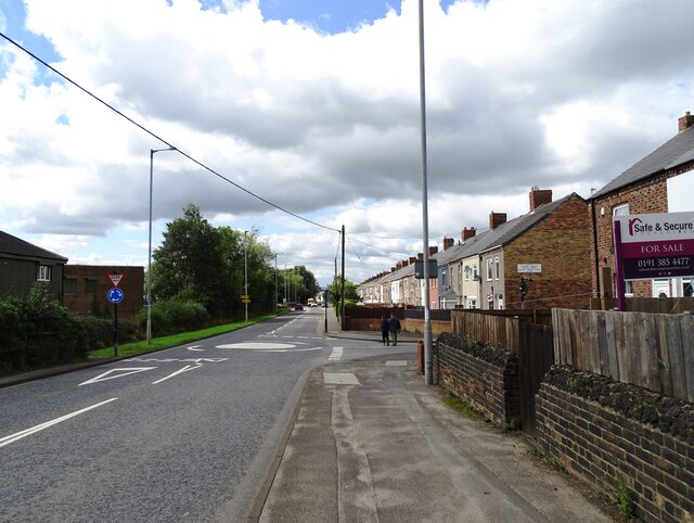
Image: © Robert Graham Taken: 15 Aug 2023
View along the B1286 in the centre of the former mining village. The terraced row on the right is Fenton Terrace dating from the late 19th century. This area was the original settlement of New Herrington in the mid 19th century. Fenton Terrace and the streets behind it were added a few years later to cater for the miners for the expanding colliery.
Images are licensed for reuse under creativecommons.org/licenses/by-sa/2.0
Image Location

Latitude
54.869204
Longitude
-1.47627