Huntingdon Hall
Introduction
The photograph on this page of Huntingdon Hall by Ian Capper as part of the Geograph project.
The Geograph project started in 2005 with the aim of publishing, organising and preserving representative images for every square kilometre of Great Britain, Ireland and the Isle of Man.

There are currently over 7.5m images from over 14,400 individuals and you can help contribute to the project by visiting https://www.geograph.org.uk
Huntingdon Hall
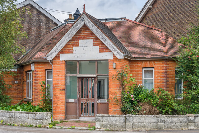
Image: © Ian Capper Taken: 26 Sep 2023
Former mission hall at 65 De La Warr Road. The building is first marked on the 1910 25 inch map, and the Spring 1994 edition of the Bulletin of the East Grinstead Society (no 54) names it as Armoury Hall, housing the Armoury Mission from the mid 1920s - 1965, a Baptist congregation from 1965-72 and the West Street Evangelical Church Sunday School from 1972-74, before being used as the offices of the Countess of Huntingdon's Connexion (a small network of evangelical churches). The plate by the door gives a current occupant as a firm of consulting engineers, Thoughtward Ltd.
Images are licensed for reuse under creativecommons.org/licenses/by-sa/2.0
Image Location
Latitude
51.125868
Longitude
-0.005284