The former Wetheriggs Pottery
Introduction
The photograph on this page of The former Wetheriggs Pottery by Chris Allen as part of the Geograph project.
The Geograph project started in 2005 with the aim of publishing, organising and preserving representative images for every square kilometre of Great Britain, Ireland and the Isle of Man.

There are currently over 7.5m images from over 14,400 individuals and you can help contribute to the project by visiting https://www.geograph.org.uk
The former Wetheriggs Pottery
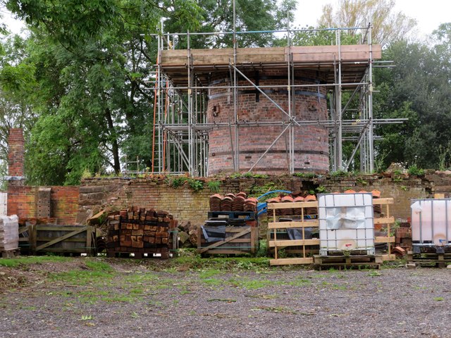
Image: © Chris Allen Taken: 30 Sep 2023
This site is being redeveloped but with retention of the key heritage features that have statutory protection. This shows the kiln that formerly had a building around it.
Images are licensed for reuse under creativecommons.org/licenses/by-sa/2.0
Image Location
Latitude
54.629766
Longitude
-2.691288