Arley industrial estate and Arley Wood
Introduction
The photograph on this page of Arley industrial estate and Arley Wood by A J Paxton as part of the Geograph project.
The Geograph project started in 2005 with the aim of publishing, organising and preserving representative images for every square kilometre of Great Britain, Ireland and the Isle of Man.

There are currently over 7.5m images from over 14,400 individuals and you can help contribute to the project by visiting https://www.geograph.org.uk
Arley industrial estate and Arley Wood
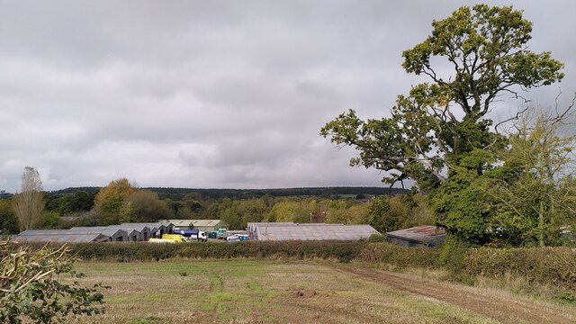
Image: © A J Paxton Taken: 24 Oct 2023
The industrial units are viewed from the path from Spring Hill to Daffern's Wood; they occupy the site of Arley Colliery, which closed in 1968. Arley Wood blankets the horizon. This ancient woodland was replanted with conifers in the 1960s, apparently to provide pit props for the mine; see Image
Images are licensed for reuse under creativecommons.org/licenses/by-sa/2.0
Image Location
Latitude
52.504596
Longitude
-1.579937