Mitton Manor, Tewkesbury
Introduction
The photograph on this page of Mitton Manor, Tewkesbury by Philip Halling as part of the Geograph project.
The Geograph project started in 2005 with the aim of publishing, organising and preserving representative images for every square kilometre of Great Britain, Ireland and the Isle of Man.

There are currently over 7.5m images from over 14,400 individuals and you can help contribute to the project by visiting https://www.geograph.org.uk
Mitton Manor, Tewkesbury
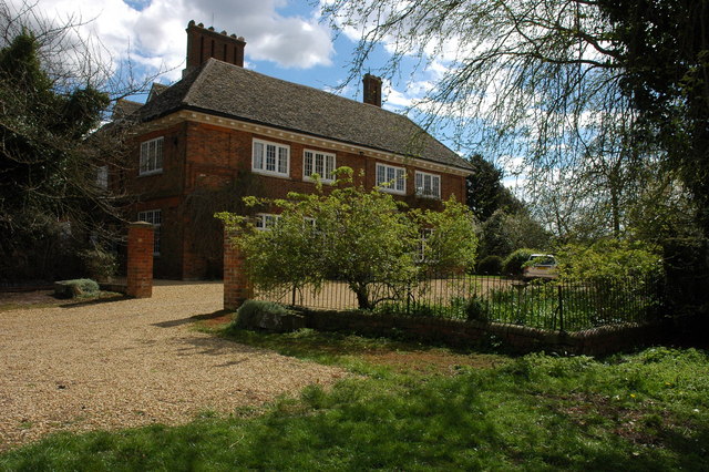
Image: © Philip Halling Taken: 12 Apr 2008
Mitton Manor was surrounded by fields until the early 1960s when the Mitton housing estate was built on adjoining land. Mitton is now in Gloucestershire, however, before the housing estate was built it was in Worcestershire with the Carrant Brook forming the county boundary.
Images are licensed for reuse under creativecommons.org/licenses/by-sa/2.0
Image Location
Latitude
52.003003
Longitude
-2.141837