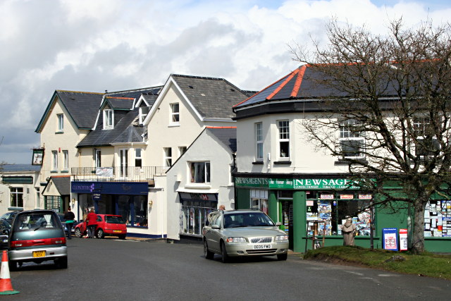
Leg O' Mutton Corner
Introduction
The photograph on this page of Leg O' Mutton Corner by Tony Atkin as part of the Geograph project.
The Geograph project started in 2005 with the aim of publishing, organising and preserving representative images for every square kilometre of Great Britain, Ireland and the Isle of Man.
There are currently over 7.5m images from over 14,400 individuals and you can help contribute to the project by visiting https://www.geograph.org.uk

Image: © Tony Atkin Taken: 13 Apr 2008
This is a strange place, it looks like a village centre having shops and a large public house/hotel but it is in an isolated position separated from the body of Yelverton by the main road to Tavistock and facing the open heathland of Roborough Down (behind the photographer). History probably has a lot to do with it. Construction of the airfield for RAF Harrowbeer in WWII forced the main road to be moved away from this corner. Nowadays the area probably survives on the fact that it is easy to park a car here.

