Old Milestone by the B1044, Stukeley Road, Huntingdon parish
Introduction
The photograph on this page of Old Milestone by the B1044, Stukeley Road, Huntingdon parish by Mark Brotherton as part of the Geograph project.
The Geograph project started in 2005 with the aim of publishing, organising and preserving representative images for every square kilometre of Great Britain, Ireland and the Isle of Man.

There are currently over 7.5m images from over 14,400 individuals and you can help contribute to the project by visiting https://www.geograph.org.uk
Old Milestone by the B1044, Stukeley Road, Huntingdon parish
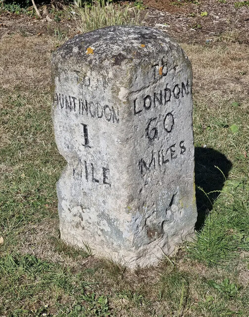
Image: © Mark Brotherton Taken: 7 Jul 2022
Carved stone post by the B1043, in parish of HUNTINGDON (HUNTINGDONSHIRE District), Stukeley Road. Re-located to North side of road, on wide grass verge behind bus shelter, by "Dunelm" store, near junction with St Margarets Way. Huntingdon stone, erected by the Royston to Wandesford Bridge (South District) turnpike trust in the 19th century. Inscription reads:- : TO / HUNTINGDON / 1 / MILE : : TO / LONDON / 60 / MILES : Milestone Society National ID: HU_LYA60.
Images are licensed for reuse under creativecommons.org/licenses/by-sa/2.0
Image Location
Latitude
52.340569
Longitude
-0.194342