
Jackson's Mill, Easington
Introduction
The photograph on this page of Jackson's Mill, Easington by Ian Dodds as part of the Geograph project.
The Geograph project started in 2005 with the aim of publishing, organising and preserving representative images for every square kilometre of Great Britain, Ireland and the Isle of Man.

There are currently over 7.5m images from over 14,400 individuals and you can help contribute to the project by visiting https://www.geograph.org.uk
Jackson's Mill, Easington
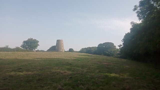
Image: © Ian Dodds Taken: 8 Sep 2023
Current online large-scale maps refer to this eye-catching building as simply 'The Mill'. Historic England - who made it a Grade II listed building in the 1960s - refer to it by its older name though. It appears on Ordnance Survey's first map of here, surveyed in the 1850s; they also refer to the round tower as Jackson's Mill and state that it was used for grinding corn. The small attached more conventional part of the property was added in 1980 and Historic England make clear in their short write-up that this newer part is of no architectural interest whatsoever. Both the old and new parts are lived in today as part of the same property but it isn't clear whether the old windmill had been used as a home - when it was working or afterwards - before the 1980 revamp. A neglected footpath leads from the camera location to a gate to the left of the house and then continues to the main road along its driveway.
Images are licensed for reuse under creativecommons.org/licenses/by-sa/2.0
Image Location

Latitude
54.786623
Longitude
-1.364443