
The New Pot Oil, Wrenthorpe
Introduction
The photograph on this page of The New Pot Oil, Wrenthorpe by Stephen Craven as part of the Geograph project.
The Geograph project started in 2005 with the aim of publishing, organising and preserving representative images for every square kilometre of Great Britain, Ireland and the Isle of Man.

There are currently over 7.5m images from over 14,400 individuals and you can help contribute to the project by visiting https://www.geograph.org.uk
The New Pot Oil, Wrenthorpe
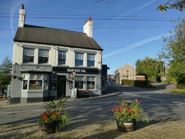
Image: © Stephen Craven Taken: 15 Oct 2023
To most Yorkshire folk, a 'pot'oil' is a pothole in the road (or perhaps a cave). Locally here, it refers to the pot ovens that gave the village its former name. According to Whatpub.com, the pub was built as the Malt Shovel in the 1860s, rebuilt 1899, called the Pot 'Oil from the 1970s to 1988, then The Potovens until 1991. The outside, at least, has had a makeover since 2019 Image and other photos on this site show earlier decoration schemes.
Images are licensed for reuse under creativecommons.org/licenses/by-sa/2.0
Image Location

Latitude
53.698268
Longitude
-1.525441