Wall to 1 Rose Hill
Introduction
The photograph on this page of Wall to 1 Rose Hill by Ian Capper as part of the Geograph project.
The Geograph project started in 2005 with the aim of publishing, organising and preserving representative images for every square kilometre of Great Britain, Ireland and the Isle of Man.

There are currently over 7.5m images from over 14,400 individuals and you can help contribute to the project by visiting https://www.geograph.org.uk
Wall to 1 Rose Hill
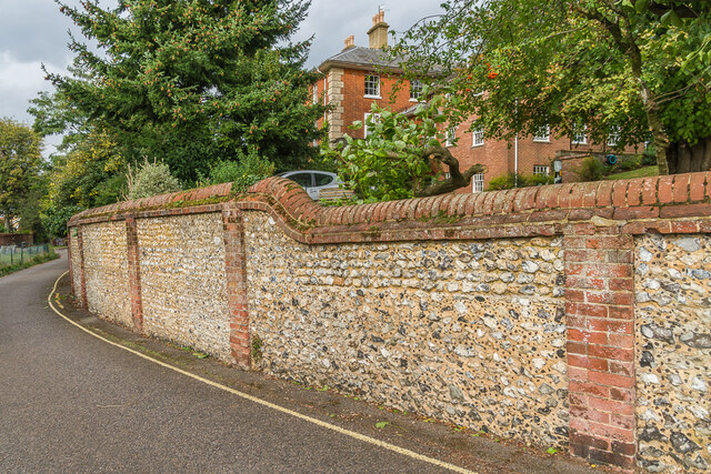
Image: © Ian Capper Taken: 11 Oct 2023
Wall of 1 Rose Hill (named Holly House) alongside Rose Hill. Note the galleting in the wall. Both the house (dating from the mid 19th Century, seen in the background) and the wall are grade II listed - see https://historicengland.org.uk/listing/the-list/list-entry/1229454?section=official-list-entry and https://historicengland.org.uk/listing/the-list/list-entry/1229455?section=official-list-entry respectively.
Images are licensed for reuse under creativecommons.org/licenses/by-sa/2.0
Image Location
Latitude
51.230015
Longitude
-0.332081