12-14 Withington Road, Manchester
Introduction
The photograph on this page of 12-14 Withington Road, Manchester by Stephen Richards as part of the Geograph project.
The Geograph project started in 2005 with the aim of publishing, organising and preserving representative images for every square kilometre of Great Britain, Ireland and the Isle of Man.

There are currently over 7.5m images from over 14,400 individuals and you can help contribute to the project by visiting https://www.geograph.org.uk
12-14 Withington Road, Manchester
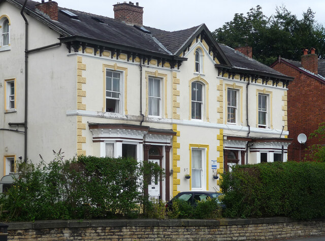
Image: © Stephen Richards Taken: 17 Aug 2016
One of three surviving pairs of early Victorian villas from a development by the banker Samuel Brooks. He built up the area from the early 1830s and named it Whalley Range. Grade II listed.
Images are licensed for reuse under creativecommons.org/licenses/by-sa/2.0
Image Location
Latitude
53.457141
Longitude
-2.258842