Floodgate, West Quay, Newhaven
Introduction
The photograph on this page of Floodgate, West Quay, Newhaven by Robin Stott as part of the Geograph project.
The Geograph project started in 2005 with the aim of publishing, organising and preserving representative images for every square kilometre of Great Britain, Ireland and the Isle of Man.

There are currently over 7.5m images from over 14,400 individuals and you can help contribute to the project by visiting https://www.geograph.org.uk
Floodgate, West Quay, Newhaven
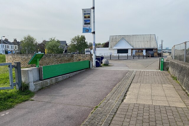
Image: © Robin Stott Taken: 14 May 2023
A nearby Environment Agency sign explains that the Newhaven Flood Alleviation Scheme, opened on 15 October 2021, reduces flood risk from the tidal River Ouse (adjacent, out of shot right). On site it's not obvious which direction the water would come from: presumably downstream, behind the camera. With the gate closed, the pressure of the water would keep it closed against the cill. Photo number 7623670.
Images are licensed for reuse under creativecommons.org/licenses/by-sa/2.0
Image Location
Latitude
50.792306
Longitude
0.052081