Spynie Canal
Introduction
The photograph on this page of Spynie Canal by Anne Burgess as part of the Geograph project.
The Geograph project started in 2005 with the aim of publishing, organising and preserving representative images for every square kilometre of Great Britain, Ireland and the Isle of Man.

There are currently over 7.5m images from over 14,400 individuals and you can help contribute to the project by visiting https://www.geograph.org.uk
Spynie Canal
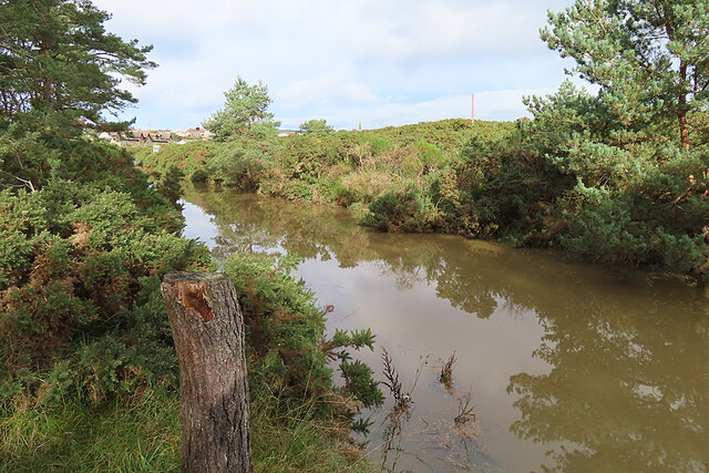
Image: © Anne Burgess Taken: 12 Oct 2023
Spynie Canal is about 7 miles long. It was built in 1808-1812 to a plan by Thomas Telford to drain the low-lying land between Elgin and the coast. It was damaged by the great floods of 1829, but rebuilt in 1860-1863. In the background here are some of the buildings in Lossiemouth, where the canal reaches the estuary of the River Lossie.
Images are licensed for reuse under creativecommons.org/licenses/by-sa/2.0
Image Location
Latitude
57.711938
Longitude
-3.282069