old Boundary Marker on Bogs Lane, Starbeck
Introduction
The photograph on this page of old Boundary Marker on Bogs Lane, Starbeck by T Exley as part of the Geograph project.
The Geograph project started in 2005 with the aim of publishing, organising and preserving representative images for every square kilometre of Great Britain, Ireland and the Isle of Man.

There are currently over 7.5m images from over 14,400 individuals and you can help contribute to the project by visiting https://www.geograph.org.uk
old Boundary Marker on Bogs Lane, Starbeck
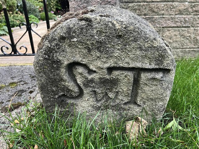
Image: © T Exley Taken: 1 Oct 2023
Township Boundary Marker on the northeast side of Bogs Lane, Starbeck, beside the front garden gate of No.6. Inscribed S w T on the southwest face and K on the northeast face to indicate the boundary of Scriven with Tentergate and Knaresborough townships as shown on the 6" OS map published in 1856. Milestone Society National ID: YW_HARR06pb
Images are licensed for reuse under creativecommons.org/licenses/by-sa/2.0
Image Location
Latitude
54.003261
Longitude
-1.495464