OS Flush Bracket - Corwen Manor
Introduction
The photograph on this page of OS Flush Bracket - Corwen Manor by Richard Law as part of the Geograph project.
The Geograph project started in 2005 with the aim of publishing, organising and preserving representative images for every square kilometre of Great Britain, Ireland and the Isle of Man.

There are currently over 7.5m images from over 14,400 individuals and you can help contribute to the project by visiting https://www.geograph.org.uk
OS Flush Bracket - Corwen Manor
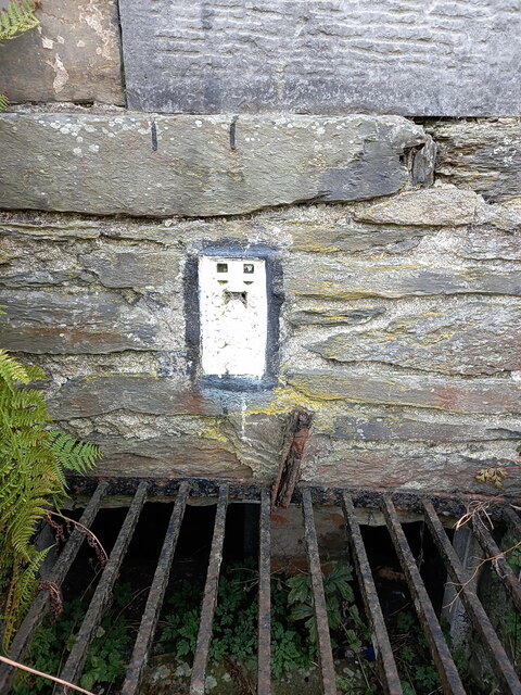
Image: © Richard Law Taken: 12 Oct 2023
Located a few feet to the right of the porticoed front entrance to the Image, and picked out in white paint with a black margin. This flush bracket was last levelled by the OS in 1975 at 136.266m above Ordnance Datum Newlyn.
Images are licensed for reuse under creativecommons.org/licenses/by-sa/2.0
Image Location


Leaflet Map data © OpenStreetMap
Latitude
52.980024
Longitude
-3.371315