View over Richmond
Introduction
The photograph on this page of View over Richmond by Marathon as part of the Geograph project.
The Geograph project started in 2005 with the aim of publishing, organising and preserving representative images for every square kilometre of Great Britain, Ireland and the Isle of Man.

There are currently over 7.5m images from over 14,400 individuals and you can help contribute to the project by visiting https://www.geograph.org.uk
View over Richmond
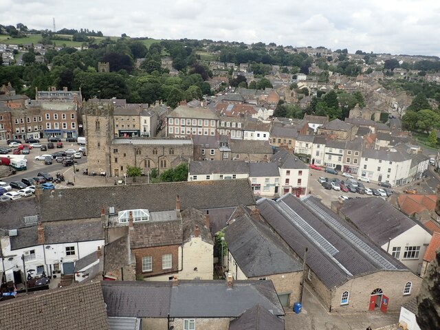
Image: © Marathon Taken: 16 Aug 2023
Richmond (Norman-French for strong hill) was founded by Alan Rufus with the resources of a vast gift of lands granted by William the Conqueror after 1071. The lands became known as the Honour of Richmond with at its hub the castle. It has been described as perhaps the most complete 11th century survival of its kind in Europe. It was planned with the wider town, partly to dominate and the keep was added in about 1160. To people at the time, the keep which is over 100 feet high would have been astonishing. The castle fell into ruin from the 15th century. In the 1850s the keep was restored. The whole is now owned by English Heritage. This view looks down from the top of the keep towards the heart of Richmond around Trinity Church which now houses The Green Howards Museum. Trinity Church Square is on its left.
Images are licensed for reuse under creativecommons.org/licenses/by-sa/2.0
Image Location
Latitude
54.403547
Longitude
-1.73701