Side elevation of Paton’s Mill or Chapel Works, Montrose, Angus
Introduction
The photograph on this page of Side elevation of Paton’s Mill or Chapel Works, Montrose, Angus by Adrian Diack as part of the Geograph project.
The Geograph project started in 2005 with the aim of publishing, organising and preserving representative images for every square kilometre of Great Britain, Ireland and the Isle of Man.

There are currently over 7.5m images from over 14,400 individuals and you can help contribute to the project by visiting https://www.geograph.org.uk
Side elevation of Paton’s Mill or Chapel Works, Montrose, Angus
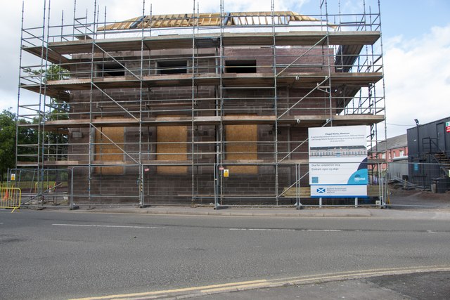
Image: © Adrian Diack Taken: 1 Jul 2023
The accompanying photo looks north from a position on Marine Avenue near the junction with Eastern Road and it shows a side elevation of the remaining part of what was Paton’s Mill in Montrose. Most of the former flax spinning factory has been demolished over the years but this remaining part is being converted into new homes. The information board beside the development shows an image of the former mill with the caption “Chapel Works, Montrose. A partnership between Scottish Government, Hillcrest Homes and George Martin Builders to bring an exciting development of 26 new homes. Due for completion 2024”.
Images are licensed for reuse under creativecommons.org/licenses/by-sa/2.0
Image Location
Latitude
56.709958
Longitude
-2.462565