35 -39 Eastgate, Louth
Introduction
The photograph on this page of 35 -39 Eastgate, Louth by Richard Law as part of the Geograph project.
The Geograph project started in 2005 with the aim of publishing, organising and preserving representative images for every square kilometre of Great Britain, Ireland and the Isle of Man.

There are currently over 7.5m images from over 14,400 individuals and you can help contribute to the project by visiting https://www.geograph.org.uk
35 -39 Eastgate, Louth
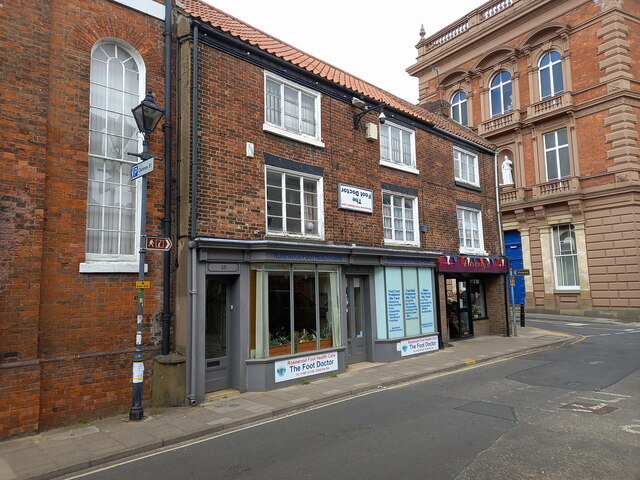
Image: © Richard Law Taken: 22 May 2023
Nos 35 - 39 Eastgate date from the early 19th century, and were probably built as houses in he first place, with the shopfronts being a later alteration. They were collectively Grade II listed https://britishlistedbuildings.co.uk/101359882-35-39-eastgate-louth & https://historicengland.org.uk/listing/the-list/list-entry/1359882 in 1974. There seems to be some sort of local tradition in mounting the business's sign upside-down on the front wall - this began in the early 20th century when the place was a general grocery store and the sign came off in a storm. It was accidentally put back upside-down, and became a local talking point for that reason; the owner kept it that way at the time, working on the basis that "Any publicity is good publicity". Since then the place has changed hands a number of times, going through phases as a stationery shop & bookstore, a newsagent, a dance studio and latterly a footcare business, and touchingly all the proprietors have kept the tradition going.
Images are licensed for reuse under creativecommons.org/licenses/by-sa/2.0
Image Location
Latitude
53.367154
Longitude
-0.005395