18 & 20 Cornmarket, Louth
Introduction
The photograph on this page of 18 & 20 Cornmarket, Louth by Richard Law as part of the Geograph project.
The Geograph project started in 2005 with the aim of publishing, organising and preserving representative images for every square kilometre of Great Britain, Ireland and the Isle of Man.

There are currently over 7.5m images from over 14,400 individuals and you can help contribute to the project by visiting https://www.geograph.org.uk
18 & 20 Cornmarket, Louth
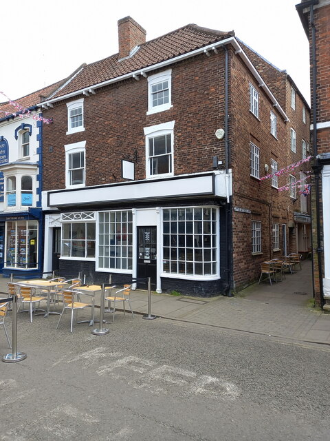
Image: © Richard Law Taken: 22 May 2023
Nos 18 & 20 date from the 18th century, and were probably built as houses, then later converted to commercial use - the windows and glazing to no 20 on the right are original early 19th century. They were collectively Grade II listed https://britishlistedbuildings.co.uk/101063245-18-and-20-cornmarket-louth & https://historicengland.org.uk/listing/the-list/list-entry/1063245 in 1974.
Images are licensed for reuse under creativecommons.org/licenses/by-sa/2.0
Image Location
Latitude
53.366248
Longitude
-0.005498