Benchmark - Larkin Lodge - Rudding Dower - Crimple (2)
Introduction
The photograph on this page of Benchmark - Larkin Lodge - Rudding Dower - Crimple (2) by Tez Exley as part of the Geograph project.
The Geograph project started in 2005 with the aim of publishing, organising and preserving representative images for every square kilometre of Great Britain, Ireland and the Isle of Man.

There are currently over 7.5m images from over 14,400 individuals and you can help contribute to the project by visiting https://www.geograph.org.uk
Benchmark - Larkin Lodge - Rudding Dower - Crimple (2)
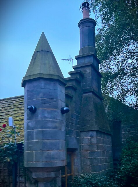
Image: © Tez Exley Taken: 27 Sep 2023
Octagonal Turret on Larkin Lodge, Rudding Dower behind Rudding Lane, next to Rudding Park, Crimple near Harrogate. There is an Ordnance Survey benchmark cut into the octagonal tower. Associated photos can be seen at the links below. Image] Image]
Images are licensed for reuse under creativecommons.org/licenses/by-sa/2.0
Image Location
Latitude
53.977382
Longitude
-1.49041