Former library, Higham Ferrers
Introduction
The photograph on this page of Former library, Higham Ferrers by Jonathan Thacker as part of the Geograph project.
The Geograph project started in 2005 with the aim of publishing, organising and preserving representative images for every square kilometre of Great Britain, Ireland and the Isle of Man.

There are currently over 7.5m images from over 14,400 individuals and you can help contribute to the project by visiting https://www.geograph.org.uk
Former library, Higham Ferrers
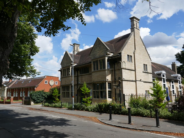
Image: © Jonathan Thacker Taken: 16 Aug 2023
Closed as a library in 2020 as part of County Council cutbacks. Dates from 1904 and designed by W. Talbot Brown https://architecture.arthistoryresearch.net/architects/brown-walter-talbot
Images are licensed for reuse under creativecommons.org/licenses/by-sa/2.0
Image Location


Leaflet Map data © OpenStreetMap
Latitude
52.30683
Longitude
-0.590461