Stourbridge Locks No 2 near Brierley Hill, Dudley
Introduction
The photograph on this page of Stourbridge Locks No 2 near Brierley Hill, Dudley by Roger Kidd as part of the Geograph project.
The Geograph project started in 2005 with the aim of publishing, organising and preserving representative images for every square kilometre of Great Britain, Ireland and the Isle of Man.

There are currently over 7.5m images from over 14,400 individuals and you can help contribute to the project by visiting https://www.geograph.org.uk
Stourbridge Locks No 2 near Brierley Hill, Dudley
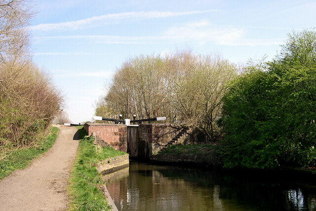
Image: © Roger Kidd Taken: 4 Apr 2007
Looking north-east towards top lock No 1 on the Stourbridge Canal. Stourbridge Top Lock (No. 2) is the second in a flight of sixteen which lower the water level by 145 feet (about 44 metres). A further four locks at Stourton complete the drop to the Staffordshire and Worcestershire Canal.
Images are licensed for reuse under creativecommons.org/licenses/by-sa/2.0
Image Location
Latitude
52.482004
Longitude
-2.144553