Ninfield Reservoir
Introduction
The photograph on this page of Ninfield Reservoir by Simon Carey as part of the Geograph project.
The Geograph project started in 2005 with the aim of publishing, organising and preserving representative images for every square kilometre of Great Britain, Ireland and the Isle of Man.

There are currently over 7.5m images from over 14,400 individuals and you can help contribute to the project by visiting https://www.geograph.org.uk
Ninfield Reservoir
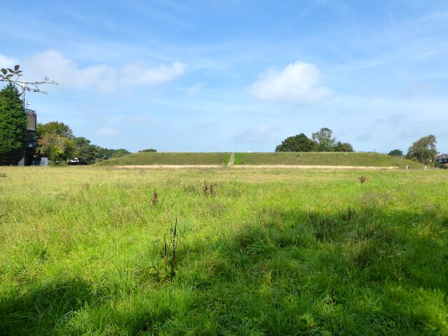
Image: © Simon Carey Taken: 3 Sep 2023
The covered reservoir was built in the first decade of the 20th century with the water tower on the left added in the 1960s. Just visible on top of the reservoir is a trig point.
Images are licensed for reuse under creativecommons.org/licenses/by-sa/2.0
Image Location
Latitude
50.889133
Longitude
0.415651