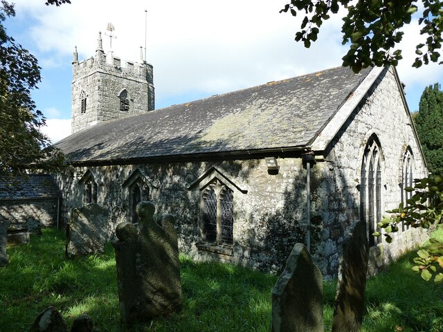
St Dennis - Church of St Dennis
Introduction
The photograph on this page of St Dennis - Church of St Dennis by Rob Farrow as part of the Geograph project.
The Geograph project started in 2005 with the aim of publishing, organising and preserving representative images for every square kilometre of Great Britain, Ireland and the Isle of Man.
There are currently over 7.5m images from over 14,400 individuals and you can help contribute to the project by visiting https://www.geograph.org.uk

Image: © Rob Farrow Taken: 2 Sep 2023
The little church of St Dennis after which the village is named sits atop a hill to the north of the village with commanding views of the surrounding countryside with its extensive China Clay workings much in evidence. The church dates originally from the late C14th or early C15th with a later C15th tower. The church was substantially rebuilt in 1847. It was badly damaged by fire in 1985, but has once again risen from the ashes. It is set in a charmingly bucolic churchyard with two particularly interesting items, a font and a stone cross. On some of the signs the church is referred to as St Denys rather than Dennis. It is possible that rather than being a saint of this name, it references "dinas" which is the Cornish for fort; there may well have been a hill-fort on this site. EH Grade II* listed: https://historicengland.org.uk/listing/the-list/list-entry/1327433?section=official-list-entry See also Image and Image

