
Doon Castle Broch, High Ardwell.
Introduction
The photograph on this page of Doon Castle Broch, High Ardwell. by Colin McDonald as part of the Geograph project.
The Geograph project started in 2005 with the aim of publishing, organising and preserving representative images for every square kilometre of Great Britain, Ireland and the Isle of Man.

There are currently over 7.5m images from over 14,400 individuals and you can help contribute to the project by visiting https://www.geograph.org.uk
Doon Castle Broch, High Ardwell.
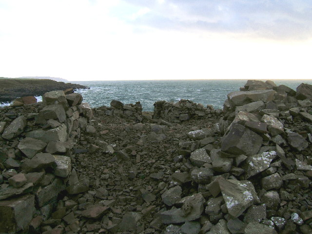
Image: © Colin McDonald Taken: 6 Nov 2005
This pile of stones is all that remains of Doon Castle Broch. Dating from approx 100BC it would have presented a spectacular sight when first built. The remains of a doorway and some lower walls can still be seen, but the remainder has collapsed. This castle occupied a prominent position at High Ardwell point and great views to the south towards the Mull of Galloway (as per photo) and west towards Northern Ireland can be had. Unfortunately, this photo was taken on a dull day, but I will endeavour to post a better photo of this location soon. Dating from approx 100BC, would have presented a spectacular sight when first built.
Images are licensed for reuse under creativecommons.org/licenses/by-sa/2.0
Image Location

Latitude
54.759968
Longitude
-5.004231