The King of Prussia, Penpergwm
Introduction
The photograph on this page of The King of Prussia, Penpergwm by Colin Cheesman as part of the Geograph project.
The Geograph project started in 2005 with the aim of publishing, organising and preserving representative images for every square kilometre of Great Britain, Ireland and the Isle of Man.

There are currently over 7.5m images from over 14,400 individuals and you can help contribute to the project by visiting https://www.geograph.org.uk
The King of Prussia, Penpergwm
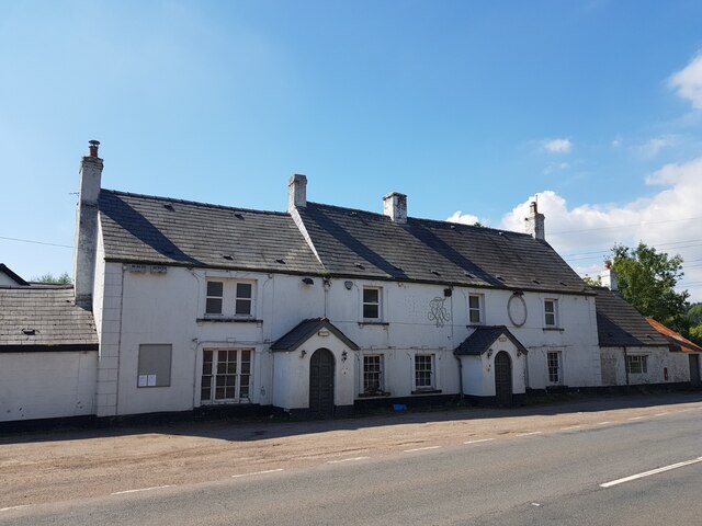
Image: © Colin Cheesman Taken: 3 Sep 2023
The King of Prussia Public House lies on the southern side of the B4598 in the village of Penpergwm. It is shown on the 1881 edition of the Ordnance Survey map. Like many rural pubs it has suffered from loss of trade and has been closed for years. It sits in front of a plant hire company who have sought permission to demolish it. The local council are questioning some details, but it seems its fate is sealed.
Images are licensed for reuse under creativecommons.org/licenses/by-sa/2.0
Image Location
Latitude
51.786215
Longitude
-2.965908