Piping diagram, Sawston Water Tower
Introduction
The photograph on this page of Piping diagram, Sawston Water Tower by Keith Edkins as part of the Geograph project.
The Geograph project started in 2005 with the aim of publishing, organising and preserving representative images for every square kilometre of Great Britain, Ireland and the Isle of Man.

There are currently over 7.5m images from over 14,400 individuals and you can help contribute to the project by visiting https://www.geograph.org.uk
Piping diagram, Sawston Water Tower
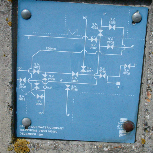
Image: © Keith Edkins Taken: 9 Apr 2008
You thought there would be just one big pipe in and one big pipe out? Think again! Actually the pattern of dotted lines, and the M possibly representing a double gate, suggests these pipes are under the roads rather than the tower site. Notice the standardisation - there are three 10" pipes and one 250mm!
Images are licensed for reuse under creativecommons.org/licenses/by-sa/2.0
Image Location
Latitude
52.127249
Longitude
0.174654