The Rye & Holywell Mead Information Board
Introduction
The photograph on this page of The Rye & Holywell Mead Information Board by David Hillas as part of the Geograph project.
The Geograph project started in 2005 with the aim of publishing, organising and preserving representative images for every square kilometre of Great Britain, Ireland and the Isle of Man.
There are currently over 7.5m images from over 14,400 individuals and you can help contribute to the project by visiting https://www.geograph.org.uk

Image: © David Hillas Taken: 26 Aug 2023
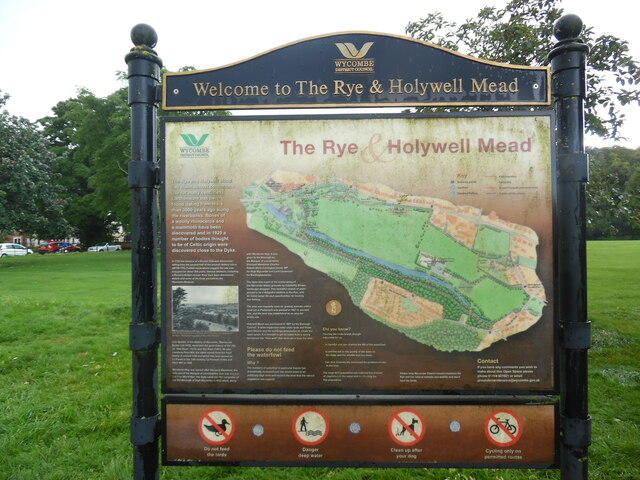
This information board has been provided by the former Wycombe District Council and is at the eastern entrance to The Rye & Holywell Mead off Bassetsbury Lane. It has the following wording and images: The Rye & Holywell Mead Map of The Rye & Holywell Mead The Rye and Holywell Mead can claim almost continuous use for many centuries. Earthenware has been found dating from more than 3000 years ago along the riverbanks. Bones of a woolly rhinoceros and a mammoth have been discovered and in 1929 a number of bodies thought to be of Celtic origin were discovered close to the Dyke. In 1722 the remains of a Roman Villa was discovered dating from the second half of the second century (circa AD150-170). Further excavations suggest the site was occupied for about 200 years. Various artefacts, including a Romano-British mosaic floor have been discovered, details and some of the finds are held by the Wycombe Museum. Image View across to the Rye from Warren Wood showing cows grazing on the Rye - Photograph copyright of Wycombe Museum. Ivan Sparks, in his History of Wycombe (Barracuda Books Ltd 1979), illustrates the great history of the site as 'Atte Reye' (1372) and The Reye (1451). He also mentions Pann Mill, the name comes from the Panil family of around 1150 and which has been known as La Pande in the 12th century, La Penmell (1344) and Penn Mill in 1606. Wendover Way was named after Viscount Wendover, the only son of the Marquis of Lincolnshire, who was killed in the First World War. The Dyke came into the ownership of the Old Borough of High Wycombe in 1923, when along with Wendover Way, it was given to the Borough by the Marquis of Lincolnshire, Viscount Wendover Charles Robert Wynn-Carrington former MP for High Wycombe and Lord Lieutenant for Buckinghamshire. The Dyke was a part of the landscaping of the Wycombe Abbey grounds by Capability Brown, landscape designer. This beautiful stretch of water proved to be a delightful addition to the Rye, with its varied water life and opportunities for boating and fishing. The area was regularly used for grazing animals until a local Act of Parliament was passed in 1927 to prevent this, and the land was established as an area for public use. Holywell Mead was purchased in 1937 by the Borough Council. It once supported water cress beds and these were filled in and the buildings demolished to create the open space. It is thought to get its name from a spring fed stream the "Holy well" that once ran across the area. Please do not feed the waterfowl Why? The number of waterfowl in particular Swans has dramatically increased over the recent years to an artificially high level and beyond the level that the natural vegetation can support. Did you know? Feeding the birds bread, though enjoyable for us, • is harmful and can shorten the life of the waterfowl. • is detrimental to the quality of the water in the Dyke and the wildlife that live there. • has also dramatically increased the problem of rats in the area. The large bird population has reduced the amount of vegetation in the water and is affecting the fish population. Please help Wycombe District Council maintain the Rye and the natural habitats and wildlife and don't feed the birds. Contact If you have any comments you wish to make about this Open Space please phone 01494 421821 or email "[email protected]". Foot of the notice - prohibition signs from left to right i) Do not feed the birds ii) Danger deep water iii) Clean up after your dog iv) Cycling only on permitted routes

