Direction Sign, Almley
Introduction
The photograph on this page of Direction Sign, Almley by Mr Red as part of the Geograph project.
The Geograph project started in 2005 with the aim of publishing, organising and preserving representative images for every square kilometre of Great Britain, Ireland and the Isle of Man.

There are currently over 7.5m images from over 14,400 individuals and you can help contribute to the project by visiting https://www.geograph.org.uk
Direction Sign, Almley
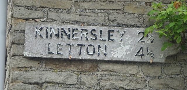
Image: © Mr Red Taken: 25 Aug 2023
Opposite the church on the house "Motte", it is also opposite the field with a motte & bailey in very recognisable preserve. Context view is Image Inscription: Kinnersley 2½ / Letton 4½ Milestone Society National ID: HF_SO3351A
Images are licensed for reuse under creativecommons.org/licenses/by-sa/2.0
Image Location
Latitude
52.157541
Longitude
-2.976281