Cliff edge of the former Greetwell Quarry, Lincoln
Introduction
The photograph on this page of Cliff edge of the former Greetwell Quarry, Lincoln by Jonathon Pile as part of the Geograph project.
The Geograph project started in 2005 with the aim of publishing, organising and preserving representative images for every square kilometre of Great Britain, Ireland and the Isle of Man.

There are currently over 7.5m images from over 14,400 individuals and you can help contribute to the project by visiting https://www.geograph.org.uk
Cliff edge of the former Greetwell Quarry, Lincoln
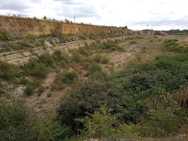
Image: © Jonathon Pile Taken: 29 Aug 2023
The exposed limestone rock face on the eastern edge of the former Greetwell Quarry rises above the scrubland below, looking southeastwards from a public footpath in the direction of the Lincoln Eastern Bypass. This photograph was taken on a mild, overcast morning in late August. Once upon a time the Greetwell Quarry was a site of extensive limestone and ironstone mining, but with the end of operations in 2003 the land has slowly been reclaimed by nature and now forms part of the Greetwell Hollow Nature Reserve, a Site of Special Scientific Interest. As a vacant plot of land the site has drawn the attention of local councils and housing developers, and along the top of the cliff is metal fencing that marks the boundary of the Greetwell Fields residential development of up to 350 new homes. If local news reporting is to be believed, the building of a new estate within the quarry itself has also been proposed! For a similar view from 2006, please see Image by Matthew Smith.
Images are licensed for reuse under creativecommons.org/licenses/by-sa/2.0
Image Location
Latitude
53.238851
Longitude
-0.495148