Holme Farmhouse, 10 Main Street, Cottesmore
Introduction
The photograph on this page of Holme Farmhouse, 10 Main Street, Cottesmore by Jo and Steve Turner as part of the Geograph project.
The Geograph project started in 2005 with the aim of publishing, organising and preserving representative images for every square kilometre of Great Britain, Ireland and the Isle of Man.

There are currently over 7.5m images from over 14,400 individuals and you can help contribute to the project by visiting https://www.geograph.org.uk
Holme Farmhouse, 10 Main Street, Cottesmore
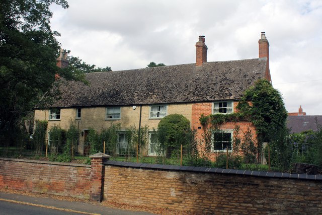
Image: © Jo and Steve Turner Taken: 24 Aug 2023
Grade II Listed 18th century house, extended in the 20th century. The listing claim that the extension is 20th century is questionable. The brickwork appears to be an inconsistent mixture of bonds and the windows suggest a pre-1840 date. At the rear of the extension is a lean-to that strangely has a ceiling beam dated as 16th century. The farm was originally part of the Exton Estate and leased with substantial land to tenant farmers. It seems to have started life in mid to late 18th century as a three room stone-built block with the rear wing connecting to the outbuildings added at an early stage. It ceased to be an active farm about 1985 and the barns and cowsheds were converted in the 1990s. The earliest reference to Holme Farm is a map of about 1730 that names William Blackley as the tenant. The map apparently shows a prior structure (origin of the beam?). Holme Farm is not named in the first 5 census returns (1841-1881). In 1913 it was described as Stone, thatch and slate roofed 10 roomed house, bath, dairy and wash house, very fair condition. This suggests the extension was extant by then. (It is also found as Home and Holm farm).
Images are licensed for reuse under creativecommons.org/licenses/by-sa/2.0
Image Location


Leaflet Map data © OpenStreetMap
Latitude
52.711054
Longitude
-0.668803