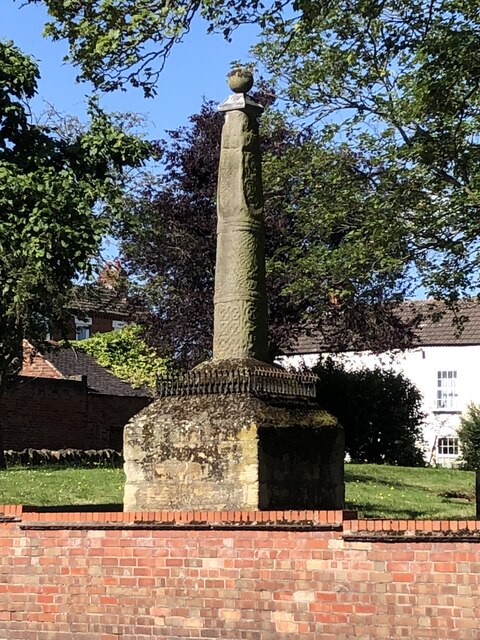
Stapleford’s Saxon Cross
Introduction
The photograph on this page of Stapleford’s Saxon Cross by Lynn Jackson as part of the Geograph project.
The Geograph project started in 2005 with the aim of publishing, organising and preserving representative images for every square kilometre of Great Britain, Ireland and the Isle of Man.
There are currently over 7.5m images from over 14,400 individuals and you can help contribute to the project by visiting https://www.geograph.org.uk

Image: © Lynn Jackson Taken: 7 Jul 2023
Stapleford is an ancient town which has been subsumed into a suburb of Nottingham. It is included in the Domesday Book (without alteration to it name). The word ‘staple’ is a Saxon word for a post next to a ford, and there is some speculation the Saxon Cross could be that post as there is no indication of a cross that has been removed from the top (although moved from its original site). Stapleford is on the route of the prehistoric Derbyshire Portway which runs from the Hemlock Stone (as possible from a site near the Trent Bridge), to Mam Tor and beyond.
Image Location


