Down Lambhay Hill, Plymouth
Introduction
The photograph on this page of Down Lambhay Hill, Plymouth by Robin Stott as part of the Geograph project.
The Geograph project started in 2005 with the aim of publishing, organising and preserving representative images for every square kilometre of Great Britain, Ireland and the Isle of Man.

There are currently over 7.5m images from over 14,400 individuals and you can help contribute to the project by visiting https://www.geograph.org.uk
Down Lambhay Hill, Plymouth
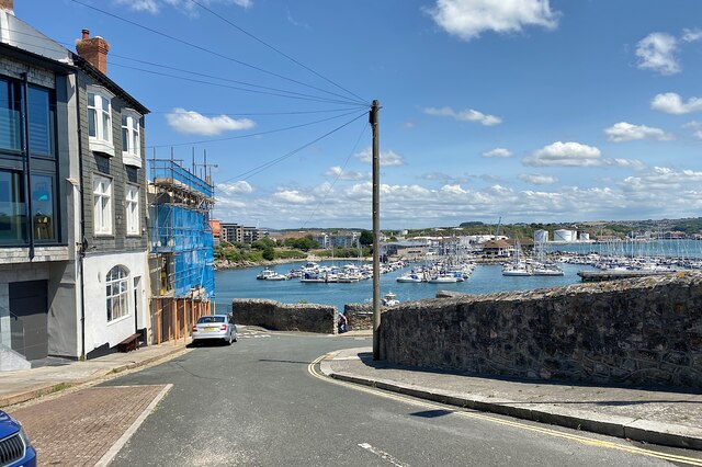
Image: © Robin Stott Taken: 29 Jun 2023
What a view to come home to! – across the harbour to St Anne's Battery marina. Someone is about to go down the steps in Image The road is a short dead-end spur off Lambhay Hill. Maps show great changes to the street plan since World War II. Photo number 7576408.
Images are licensed for reuse under creativecommons.org/licenses/by-sa/2.0
Image Location


Leaflet Map data © OpenStreetMap
Latitude
50.365481
Longitude
-4.134749