Collapsing boathouses, Alloch Dam
Introduction
The photograph on this page of Collapsing boathouses, Alloch Dam by Alan O'Dowd as part of the Geograph project.
The Geograph project started in 2005 with the aim of publishing, organising and preserving representative images for every square kilometre of Great Britain, Ireland and the Isle of Man.

There are currently over 7.5m images from over 14,400 individuals and you can help contribute to the project by visiting https://www.geograph.org.uk
Collapsing boathouses, Alloch Dam
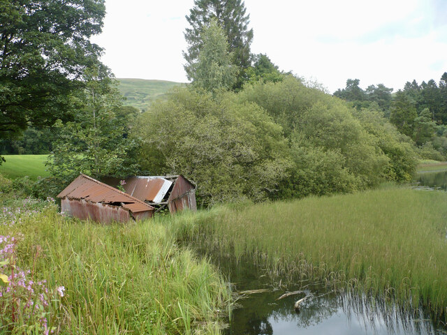
Image: © Alan O'Dowd Taken: 16 Aug 2023
These seem to have been associated with fishing on this pond, but are now in an advanced state of collapse. The plants at the bottom-left seem to be Himalayan balsam, an invasive species which is pretty rampant in the vicinity.
Images are licensed for reuse under creativecommons.org/licenses/by-sa/2.0
Image Location


Leaflet Map data © OpenStreetMap
Latitude
55.970366
Longitude
-4.175526