Old Boundary Marker on the B5288 in Motherby
Introduction
The photograph on this page of Old Boundary Marker on the B5288 in Motherby by Colin Smith as part of the Geograph project.
The Geograph project started in 2005 with the aim of publishing, organising and preserving representative images for every square kilometre of Great Britain, Ireland and the Isle of Man.

There are currently over 7.5m images from over 14,400 individuals and you can help contribute to the project by visiting https://www.geograph.org.uk
Old Boundary Marker on the B5288 in Motherby
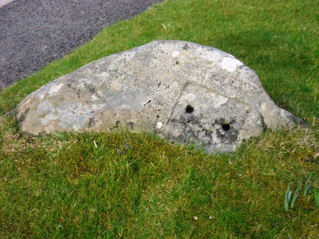
Image: © Colin Smith Taken: 19 Mar 2015
Township Boundary Marker on the verge on the southeast side of the B5288 in Motherby, outside Stag Cottage West. Until 1866 this was the boundary of Motherby and Gill and Hutton Soil townships, then Greystoke and Hutton Soil parishes until 1934, then Greystoke and Hutton parishes. Now entirely in Hutton parish. The plate on the south side is now missing. The stone is inscribed MDII (1502 if these are Roman numerals) on the north side. Milestone Society National ID: CU_HUTT02pb
Images are licensed for reuse under creativecommons.org/licenses/by-sa/2.0
Image Location
Latitude
54.646404
Longitude
-2.89027