Entry to Blakenham Lock
Introduction
The photograph on this page of Entry to Blakenham Lock by Bob Jones as part of the Geograph project.
The Geograph project started in 2005 with the aim of publishing, organising and preserving representative images for every square kilometre of Great Britain, Ireland and the Isle of Man.

There are currently over 7.5m images from over 14,400 individuals and you can help contribute to the project by visiting https://www.geograph.org.uk
Entry to Blakenham Lock
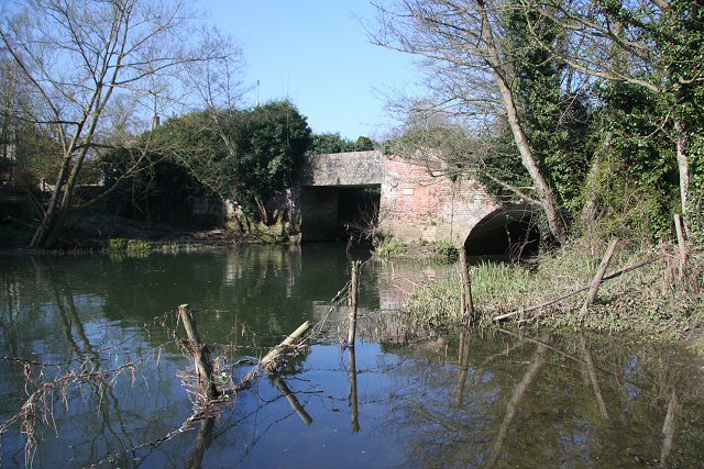
Image: © Bob Jones Taken: 8 Apr 2008
The rectangular opening to the left was the downstream entry to the former Blakenham Lock, whilst the arch to the right took the spill from the river. The bridge across the river carries the footpath to Sharpstone Street.
Images are licensed for reuse under creativecommons.org/licenses/by-sa/2.0
Image Location
Latitude
52.115788
Longitude
1.093792