Former pub, Rochdale Road, Manchester
Introduction
The photograph on this page of Former pub, Rochdale Road, Manchester by Stephen Richards as part of the Geograph project.
The Geograph project started in 2005 with the aim of publishing, organising and preserving representative images for every square kilometre of Great Britain, Ireland and the Isle of Man.

There are currently over 7.5m images from over 14,400 individuals and you can help contribute to the project by visiting https://www.geograph.org.uk
Former pub, Rochdale Road, Manchester
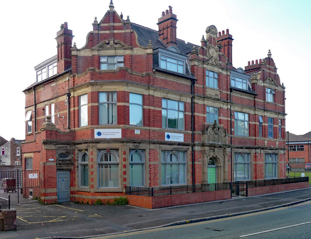
Image: © Stephen Richards Taken: 24 May 2016
Big florid Victorian pub, rebuilt in 1896. It was the Farmyard Hotel, and perhaps closed in the 2010s. At the time it housed the Harpurhey Alternative Provision School.
Images are licensed for reuse under creativecommons.org/licenses/by-sa/2.0
Image Location
Latitude
53.515028
Longitude
-2.212898