Old Boundary Marker on Lower Farm, Barton
Introduction
The photograph on this page of Old Boundary Marker on Lower Farm, Barton by Roadside Relics as part of the Geograph project.
The Geograph project started in 2005 with the aim of publishing, organising and preserving representative images for every square kilometre of Great Britain, Ireland and the Isle of Man.

There are currently over 7.5m images from over 14,400 individuals and you can help contribute to the project by visiting https://www.geograph.org.uk
Old Boundary Marker on Lower Farm, Barton
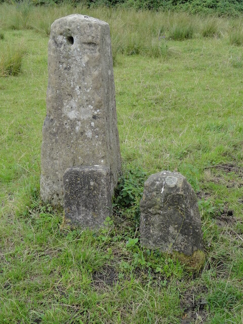
Image: © Roadside Relics Taken: 4 Aug 2023
Estate Boundary Marker in a private field behind a locked gate just north of the junction of Barton Village Road and the public footpath and private lane to Lower Farm The stone easily be seen from the road and is the smaller stone on the left in the photo. Beckley and Stowood parish. Inscribed T W / 1684. Read https://oxfordhistory.org.uk/streets/wayside_stones/boundary/1600s/barton_headington_manor.html. Grade II Listed details https://historicengland.org.uk/listing/the-list/list-entry/1485757 and https://www.oxfordmail.co.uk/news/23677109.oxford-college-plans-move-historic-stone-slammed/. Milestone Society National ID: OX_BECSTO01em
Images are licensed for reuse under creativecommons.org/licenses/by-sa/2.0
Image Location
Latitude
51.770331
Longitude
-1.20442