Old milepost
Introduction
The photograph on this page of Old milepost by Hilary Jones as part of the Geograph project.
The Geograph project started in 2005 with the aim of publishing, organising and preserving representative images for every square kilometre of Great Britain, Ireland and the Isle of Man.

There are currently over 7.5m images from over 14,400 individuals and you can help contribute to the project by visiting https://www.geograph.org.uk
Old milepost
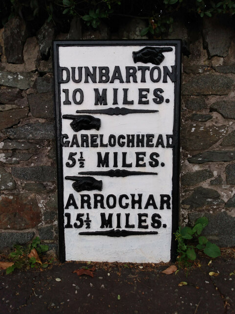
Image: © Hilary Jones Taken: 10 Aug 2023
This milepost in Rhu is one of the flat designs which are only 7cm deep. The mileposts between Dumbarton and Helensburgh are curved with a different style of hands. It is marked on the 1860 OS map but only this post on the A814 opposite the marina and a similar post in Arrochar remain by the roadside along the eastern shore of Gare Loch and Loch Long.
Images are licensed for reuse under creativecommons.org/licenses/by-sa/2.0
Image Location
Latitude
56.013762
Longitude
-4.771783