St Michaels Well, or is it?
Introduction
The photograph on this page of St Michaels Well, or is it? by Ralph Greig as part of the Geograph project.
The Geograph project started in 2005 with the aim of publishing, organising and preserving representative images for every square kilometre of Great Britain, Ireland and the Isle of Man.

There are currently over 7.5m images from over 14,400 individuals and you can help contribute to the project by visiting https://www.geograph.org.uk
St Michaels Well, or is it?
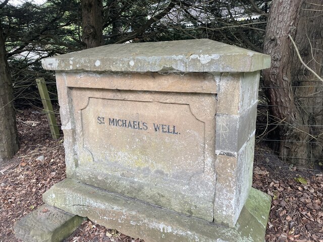
Image: © Ralph Greig Taken: 12 Aug 2023
St Michael's well. The real well is closer to town. This stone was put here in 1832 by George Gunn, factor to the Duke of Sutherland. A new law declared that only men living within 7 miles of the burgh boundary could vote in the country's elections. Dornoch's northern boundary was set at St Michael's well. Unfortunately for George his home was just outside the 7 mile limit, he could have moved house to save his vote, but instead he moved the boundary.
Images are licensed for reuse under creativecommons.org/licenses/by-sa/2.0
Image Location
Latitude
57.883324
Longitude
-4.027215