The Old Clockhouse, Linkenholt
Introduction
The photograph on this page of The Old Clockhouse, Linkenholt by Oscar Taylor as part of the Geograph project.
The Geograph project started in 2005 with the aim of publishing, organising and preserving representative images for every square kilometre of Great Britain, Ireland and the Isle of Man.

There are currently over 7.5m images from over 14,400 individuals and you can help contribute to the project by visiting https://www.geograph.org.uk
The Old Clockhouse, Linkenholt
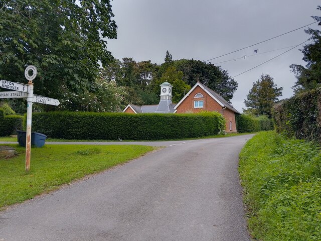
Image: © Oscar Taylor Taken: 13 Aug 2023
A house in Linkenholt. The character appraisal by Test Valley Council describes the house as follows: "built of red brick with slate roof in the early 1900’s which formerly served as a garage to The Manor House, a distinctive landmark within the village with its four sided clock tower, central copper cupola and weather vane".
Images are licensed for reuse under creativecommons.org/licenses/by-sa/2.0
Image Location


Leaflet Map data © OpenStreetMap
Latitude
51.320391
Longitude
-1.477759