
Collets Brook Farmhouse east face - Sutton Coldfield, West Midlands
Introduction
The photograph on this page of Collets Brook Farmhouse east face - Sutton Coldfield, West Midlands by Martin Richard Phelan as part of the Geograph project.
The Geograph project started in 2005 with the aim of publishing, organising and preserving representative images for every square kilometre of Great Britain, Ireland and the Isle of Man.

There are currently over 7.5m images from over 14,400 individuals and you can help contribute to the project by visiting https://www.geograph.org.uk
Collets Brook Farmhouse east face - Sutton Coldfield, West Midlands
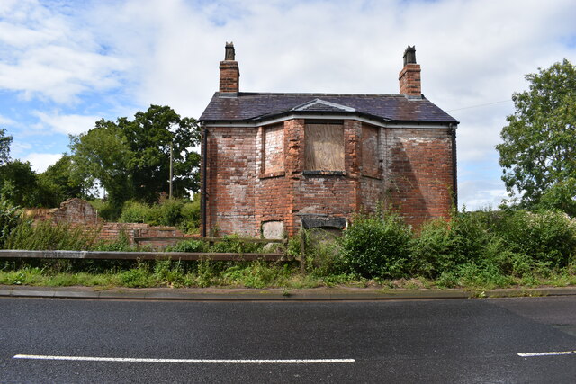
Image: © Martin Richard Phelan Taken: 12 Aug 2023
This former tollhouse dates from 1807 and was associated with the Tamworth Road Turnpike. In the mid 19th century it was extended for use as a farm house. It stands at the junction of the A453 Tamworth Road and Fox Hill Road and was Grade II listed by English Heritage on 1st March 1991. This photo was taken in the afternoon on the return leg of my journey as I didn't (did not) fancy my chances of crossing the A453 at any point. Time photo taken 13.58 pm BST (British Summer Time). Source: British Listed Buildings. Image Image Image
Images are licensed for reuse under creativecommons.org/licenses/by-sa/2.0
Image Location

Latitude
52.587715
Longitude
-1.788591