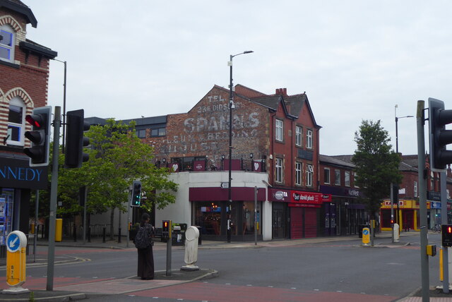
A Walk in Didsbury Village (27) School Lane Junction Buildings
Introduction
The photograph on this page of A Walk in Didsbury Village (27) School Lane Junction Buildings by Tom Jolliffe as part of the Geograph project.
The Geograph project started in 2005 with the aim of publishing, organising and preserving representative images for every square kilometre of Great Britain, Ireland and the Isle of Man.
There are currently over 7.5m images from over 14,400 individuals and you can help contribute to the project by visiting https://www.geograph.org.uk

Image: © Tom Jolliffe Taken: 20 Jul 2023
The old fading sign on the side of the tall building shows an old telephone number, the name of the establishment, Spanns, and vestiges of other words which have been either removed or worn away by changes, such as "LEUM" and "BEDDING". I suspect the former was linoleum (an early type of floor covering). The word "HOUSE" seems to be part of a larger word. Housewares? Warehouse? Perhaps an old photograph would answer the question. Lower down, there is a direction sign for the Baptist Church. A plane tree grows outside Costa and there are stainless steel hoops for cyclists to secure their bikes. Last, there is a branch of a bank, the NatWest, a sight which is becoming increasingly more infrequent in many places as digital accounts take (us) over.

