
Wheat field by Lincoln Cliff, Bracebridge Heath
Introduction
The photograph on this page of Wheat field by Lincoln Cliff, Bracebridge Heath by Jonathon Pile as part of the Geograph project.
The Geograph project started in 2005 with the aim of publishing, organising and preserving representative images for every square kilometre of Great Britain, Ireland and the Isle of Man.

There are currently over 7.5m images from over 14,400 individuals and you can help contribute to the project by visiting https://www.geograph.org.uk
Wheat field by Lincoln Cliff, Bracebridge Heath
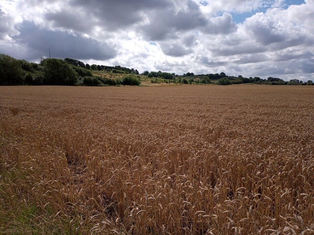
Image: © Jonathon Pile Taken: 29 Jul 2023
A field of wheat stretches to the foot of Lincoln Cliff, looking southeastwards from beyond Lincoln's eastern suburbs towards the village of Bracebridge Heath, which sits obscured by trees on the top of the escarpment. This photograph was taken on a warm and breezy morning in late July. Running north-south across central Lincolnshire for approximately 50 miles, Lincoln Cliff (also known as Lincoln Edge) is a ridge of predominantly Jurassic limestone that despite its modest height affords reasonable views to the west of Lincoln, North Hykeham, and beyond. The footpath on this side of the field is one of many walking routes that link Lincoln and Bracebridge Heath, allowing good local access to the long-distance Viking Way trail that passes along top of the escarpment. The radio mast rising above the trees on the left sits on the site of the Lincolnshire Headquarters of the East Midlands Ambulance NHS Trust.
Images are licensed for reuse under creativecommons.org/licenses/by-sa/2.0
Image Location

Latitude
53.199804
Longitude
-0.543226