Old guidestone
Introduction
The photograph on this page of Old guidestone by Chris Minto as part of the Geograph project.
The Geograph project started in 2005 with the aim of publishing, organising and preserving representative images for every square kilometre of Great Britain, Ireland and the Isle of Man.

There are currently over 7.5m images from over 14,400 individuals and you can help contribute to the project by visiting https://www.geograph.org.uk
Old guidestone
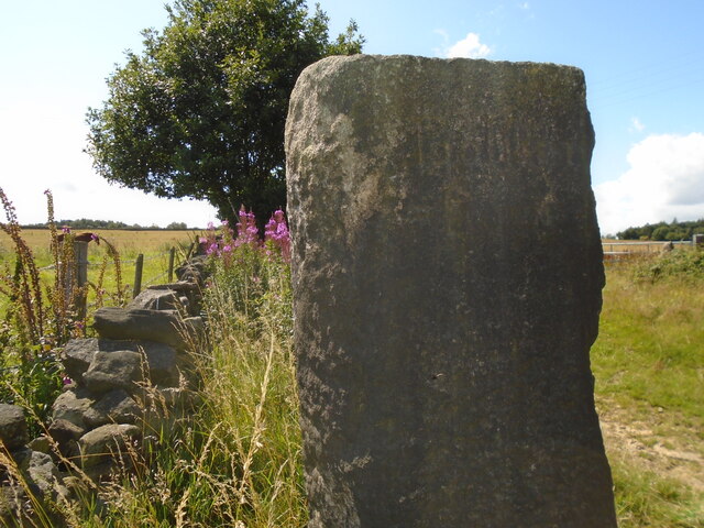
Image: © Chris Minto Taken: 29 Jul 2023
This shows the top of the Bolsterstone face of the stone at the start of Peg Folly path leading to Ewden. The worn inscription is 'Bolſter/stone'. Another long s that looks like an f. There is a cut benchmark at the base on this side. Grade II listed 1193130.
Images are licensed for reuse under creativecommons.org/licenses/by-sa/2.0
Image Location
Latitude
53.480821
Longitude
-1.620992