East Lodge, Chart Road, Ashford
Introduction
The photograph on this page of East Lodge, Chart Road, Ashford by Julian P Guffogg as part of the Geograph project.
The Geograph project started in 2005 with the aim of publishing, organising and preserving representative images for every square kilometre of Great Britain, Ireland and the Isle of Man.

There are currently over 7.5m images from over 14,400 individuals and you can help contribute to the project by visiting https://www.geograph.org.uk
East Lodge, Chart Road, Ashford
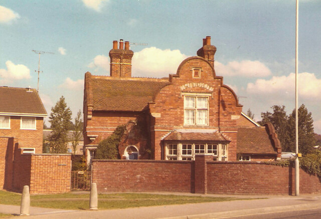
Image: © Julian P Guffogg Taken: 1 Sep 1984
This was originally the east Lodge to Godinton House. Land was sold off in the late 70's and the Godinton Estate was built. It was popular with first time buyers and young families. This was taken in 1984 when I lived nearby.
Images are licensed for reuse under creativecommons.org/licenses/by-sa/2.0
Image Location
Latitude
51.152083
Longitude
0.85581