
Horse stone
Introduction
The photograph on this page of Horse stone by Chris Minto as part of the Geograph project.
The Geograph project started in 2005 with the aim of publishing, organising and preserving representative images for every square kilometre of Great Britain, Ireland and the Isle of Man.

There are currently over 7.5m images from over 14,400 individuals and you can help contribute to the project by visiting https://www.geograph.org.uk
Horse stone
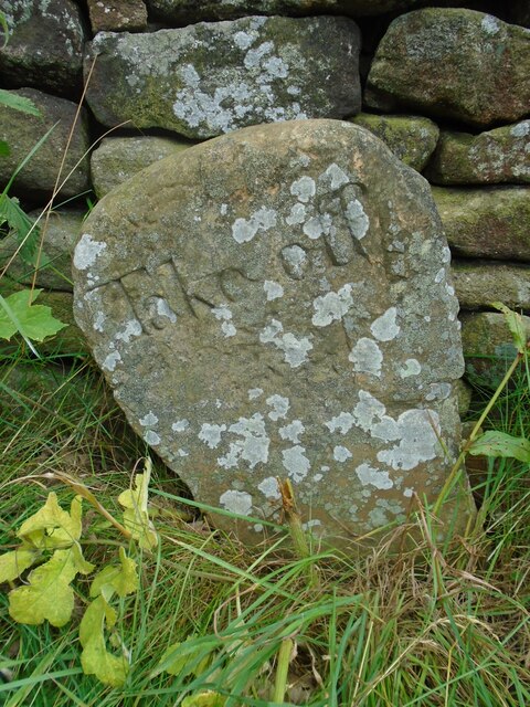
Image: © Chris Minto Taken: 1 Aug 2021
The Mortimer Road Turnpike first enacted in 1771, renewed 1792, failed by 1813. Named after Hans Winthrop Mortimer, Lord of the Manor of Bamford. It failed because it didn't make any money and didn't become an important route. But it was very hilly! Extra horses were needed and had to be paid for to help carts and carriages up very steep hills, so a stone such as this 'Take off' was placed at the top. This one is about 30m north of the 16thC Strines Inn which is 1015ft above sea level. The stone is Grade II listed 1203771.
Images are licensed for reuse under creativecommons.org/licenses/by-sa/2.0
Image Location

Latitude
53.412194
Longitude
-1.666283