Macleod Street, Nelson, Lancashire
Introduction
The photograph on this page of Macleod Street, Nelson, Lancashire by Dr Neil Clifton as part of the Geograph project.
The Geograph project started in 2005 with the aim of publishing, organising and preserving representative images for every square kilometre of Great Britain, Ireland and the Isle of Man.

There are currently over 7.5m images from over 14,400 individuals and you can help contribute to the project by visiting https://www.geograph.org.uk
Macleod Street, Nelson, Lancashire
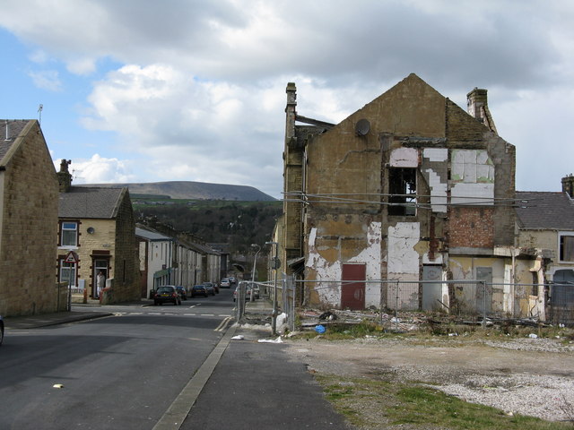
Image: © Dr Neil Clifton Taken: 5 Apr 2008
The ruined building is the remains of the presbytery attached to St. Joseph's Roman Catholic church, latterly a concrete building which occupied the vacant ground in the foreground of the picture. This had replaced an earlier building destroyed by fire in the 1960s. A great many houses on Macleod Street are awaiting demolition. The bridge just visible at the far end of the street is Whitefield Bridge 141 over the Leeds and Liverpool Canal, while on the skyline the familiar shape of Pendle Hill is visible.
Images are licensed for reuse under creativecommons.org/licenses/by-sa/2.0
Image Location
Latitude
53.835713
Longitude
-2.219993